The lake in numbers
- Carters Lake covers 3,200 acres with 62 miles of shoreline. Its average depth is 200 feet, and parts are more than 450 feet deep, making it the deepest of Georgia's reservoir lakes. U.S. Army Corps of Engineers
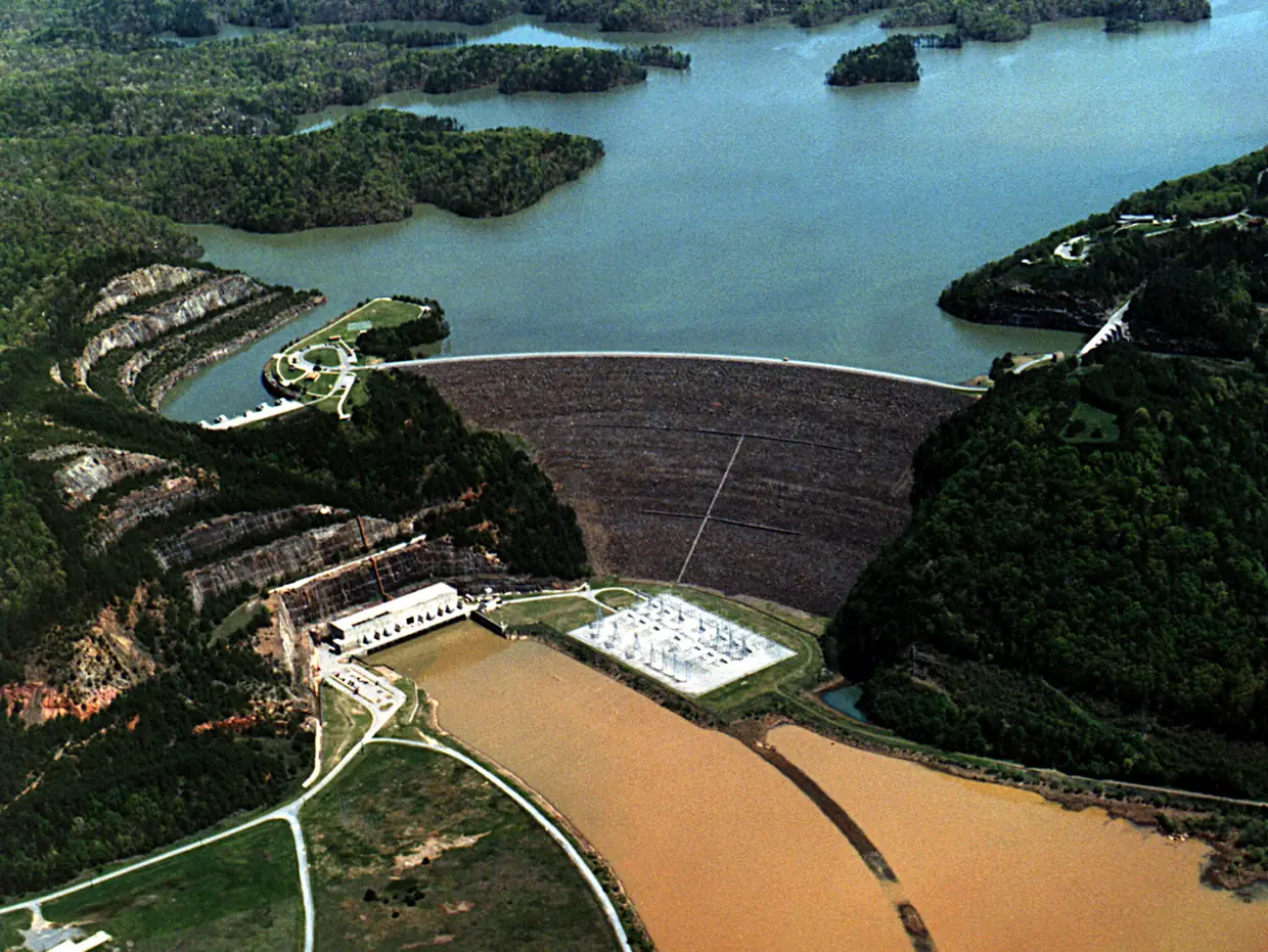
- Carters Dam, finished in 1977, is the tallest earthen dam east of the Mississippi. It controls flooding and generates power. U.S. Army Corps of Engineers
- USACE says the lake is named for 19th-century Georgia politician 'Farrish Carter Tate'. U.S. Army Corps of Engineers
The Coosawattee River flows west from Ellijay and feeds the lake (Wikipedia). The U.S. Army Corps of Engineers runs it from the Carters Lake Project Office, 975 Powerhouse Rd., Chatsworth, in Murray County, (706) 334-2248 (USACE). Carters Dam is in Murray County too. The Corps publishes no drive time from Ellijay, so we don’t give one.
Day use and fees
Most Carters Lake day-use areas charge $5.00 per vehicle, paid by credit or debit card only at automated machines. There are eight day-use areas: Woodring Branch, Doll Mountain, Harris Branch, Ridgeway, the N&S Re-regulation Areas, North Bank, Damsite and the Visitor Center. (USACE)
Harris Branch Park has a public beach open Memorial Day weekend through Labor Day. There are no lifeguards, and pets and alcohol are not allowed on the beach. (USACE)
Trails
Carters Lake trails include the Ridgeway mountain bike loop (about 6 miles, in Ridgeway Park), the Amadahy Trail (a 4-mile loop at Woodring Branch, for all skill levels) and the Tumbling Waters Nature Trail (0.35 mile one way, in Ridgeway, with an overlook of Tails Creek cascades). ATVs are banned on all trails. (USACE) Bow hunters also use the trails in hunting season.
Camping
Carters Lake campgrounds: Woodring Branch has 42 sites (31 with electric and water; phone 706-276-6050) plus an 11-site primitive area open year-round at $10 a night. Doll Mountain has 65 sites (39 with hookups; phone 706-276-4413). Book on Recreation.gov or by calling (877) 444-6777. (USACE)
Carters Lake day-use areas
U.S. Army Corps of Engineers parks
Carters Lake (Project Office: 975 Powerhouse Rd., Chatsworth, GA 30705, Murray County)
Most of the eight day-use areas charge $5.00 per vehicle, card only at automated machines. Project Office (706) 334-2248.
Source: U.S. Army Corps of Engineers, checked 2026-10-17
Harris Branch Park beach
Beach · seasonal
Carters Lake
Open Memorial Day weekend through Labor Day only, so closed in fall. No lifeguards; no pets or alcohol on the beach.
Source: U.S. Army Corps of Engineers, checked 2026-10-17
Woodring Branch and Doll Mountain campgrounds
Campgrounds
Carters Lake (Woodring Branch is about four miles off Hwy 282)
Woodring Branch: 42 sites plus an 11-site primitive area open year-round at $10 a night. Doll Mountain: 65 sites. Book on Recreation.gov or (877) 444-6777.
Source: U.S. Army Corps of Engineers, checked 2026-10-17
Ridgeway, Amadahy and Tumbling Waters trails
Trails
Ridgeway Park and Woodring Branch, Carters Lake
Ridgeway mountain-bike loop (about 6 miles), Amadahy Trail (4-mile loop for all skill levels), Tumbling Waters Nature Trail (0.35 mile one way). No ATVs.
Source: U.S. Army Corps of Engineers, checked 2026-10-17
Lake questions
How deep is Carters Lake?
Its average depth is 200 feet, and parts are more than 450 feet deep, making it the deepest of Georgia's reservoir lakes. It covers 3,200 acres with 62 miles of shoreline.
Source: U.S. Army Corps of Engineers
How much does Carters Lake cost?
Most day-use areas charge $5.00 per vehicle, paid by credit or debit card only at automated machines.
Source: U.S. Army Corps of Engineers
Is the Carters Lake beach open?
Harris Branch Park's beach is open Memorial Day weekend through Labor Day only. There are no lifeguards, and pets and alcohol are not allowed on the beach.
Source: U.S. Army Corps of Engineers
Where is Carters Dam?
The Carters Lake Project Office is at 975 Powerhouse Rd., Chatsworth, in Murray County. The dam, finished in 1977, is the tallest earthen dam east of the Mississippi.
Source: U.S. Army Corps of Engineers
Can you camp at Carters Lake?
Yes. Woodring Branch has 42 sites plus an 11-site primitive area, and Doll Mountain has 65. Book on Recreation.gov or at (877) 444-6777.
Source: U.S. Army Corps of Engineers
What trails are at Carters Lake?
The Ridgeway mountain bike loop (about 6 miles), the 4-mile Amadahy Trail at Woodring Branch, and the 0.35-mile Tumbling Waters Nature Trail. ATVs are banned on all trails.
Source: U.S. Army Corps of Engineers
Dates, hours and fees change. For anything official, the city has the final word: City of Ellijay official site